Poland's Rivers and Lakes Under Study
An information resource on freshwater biodiversity, ecosystem monitoring methods, and water quality tracking across Poland's river basins and lake districts.

How Freshwater Systems Are Assessed
Polish freshwater monitoring follows the European Water Framework Directive, combining biological, chemical, and hydromorphological indicators to classify the ecological status of surface waters.
Benthic Macroinvertebrates
Bottom-dwelling invertebrates such as mayfly, stonefly, and caddisfly larvae reflect long-term changes in water chemistry and flow regime. Their community structure serves as a direct indicator of river health.
Physicochemical Parameters
Dissolved oxygen, pH, conductivity, nitrate, and phosphate concentrations are measured at fixed gauging stations and during field campaigns, providing data on nutrient loading and pollution pressure.
Flow and Morphology
River channel structure, bank condition, and substrate composition inform hydromorphological assessments that track the physical integrity of watercourses alongside biological monitoring.
Research Topics
Three areas central to understanding freshwater ecosystems in Poland: biological indicators, community participation in data collection, and lake dynamics in glacial landscapes.

Benthic Macroinvertebrates as Bioindicators in Polish Rivers
How invertebrate community indices are applied to assess ecological status in the Vistula and Oder catchments.

Citizen Science Water Quality Monitoring in the Vistula Basin
Volunteer-driven sampling programs that extend the reach of state monitoring networks across the river's length.
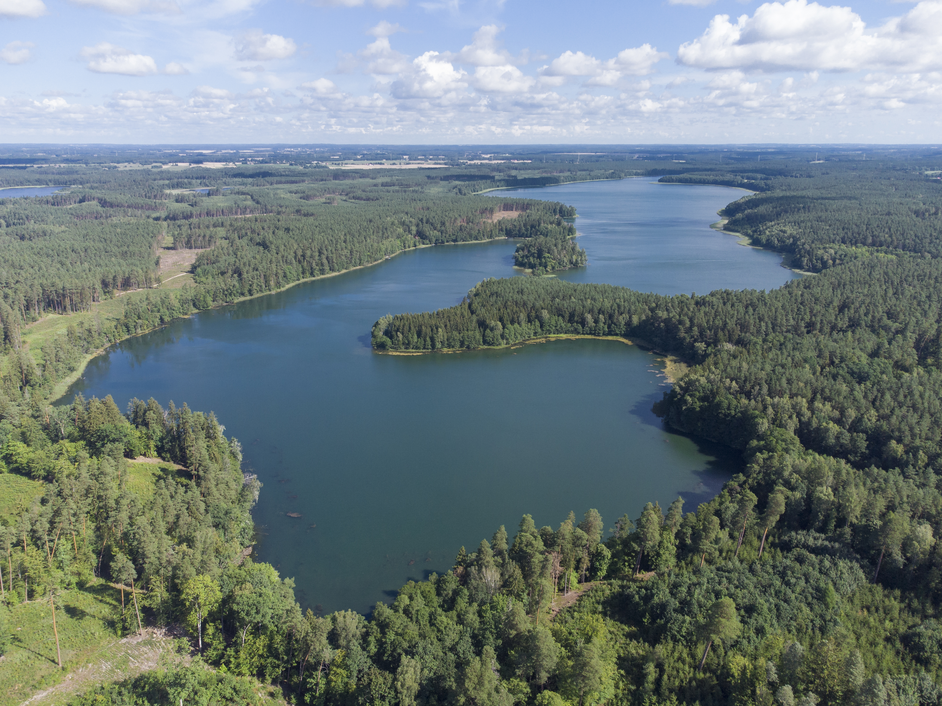
Lake Ecosystem Dynamics in the Masurian Lake District
Thermal stratification, nutrient cycles, and long-term change in one of Europe's most significant post-glacial lake regions.
Poland's Freshwater Geography
Poland lies almost entirely within the Baltic Sea drainage basin. The two dominant river systems are the Vistula (Wisła), stretching 1,047 km from the Carpathian mountains to Gdańsk Bay, and the Oder (Odra), forming much of the western border with Germany.
Together, these catchments contain thousands of smaller tributaries, wetlands, and over 9,000 lakes — the majority concentrated in the northern lake districts shaped by the last Pleistocene glaciation. The Masurian Lake District alone holds more than 2,000 lakes.

Satellite view of the Szczecin Lagoon at the Oder River mouth. Source: Copernicus / ESA, January 2026.
Send a Request
Use this form for inquiries related to the content of this resource. Submissions are reviewed periodically.